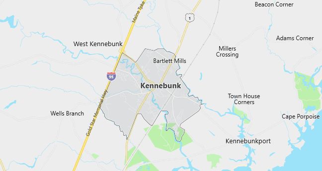
Moving to Kennebunk, Maine
Population: 10,476. Estimated population in July 2024: 11,510 (+9.9% change)
Males: 4,881 (46.6%), Females: 5,595 (53.4%)
York County
Demographics
Median resident age: 41.3 years
Median household income: $50,914
Median house value: $154,600
Population by Race
Races in Kennebunk:
- White Non-Hispanic (97.6%)
- Two or more races (0.6%)
- Hispanic (0.5%)
Ancestries: English (28.0%), Irish (21.8%), German (9.9%), French (9.1%), French Canadian (6.9%), Scottish (6.5%).
Elevation: 65 feet
Land area: 6.7 square miles

Population by Education
For population 25 years and over in Kennebunk
- High school or higher: 92.7%
- Bachelor’s degree or higher: 42.9%
- Graduate or professional degree: 17.0%
- Unemployed: 4.1%
- Mean travel time to work: 24.1 minutes
For population 15 years and over in Kennebunk town
- Never married: 18.8%
- Now married: 60.5%
- Separated: 1.2%
- Widowed: 9.5%
- Divorced: 10.0%
3.0% Foreign born (1.4% Europe, 0.7% Asia, 0.7% North America).
Hospitals
Hospitals/medical centers near Kennebunk:
- SOUTHERN MAINE MEDICAL CENTER (about 9 miles; BIDDEFORD, ME)
- HENRIETTA D GOODALL HOSPITAL (about 15 miles; SANFORD, ME)
- YORK HOSPITAL (about 18 miles; YORK, ME)
Airports
Airports certified for carrier operations nearest to Kennebunk:
- PORTLAND INTL JETPORT (about 24 miles; PORTLAND, ME; Abbreviation: PWM)
- PEASE INTERNATIONAL TRADEPORT (about 30 miles; PORTSMOUTH, NH; Abbreviation: PSM)
- BRUNSWICK NAS (about 55 miles; BRUNSWICK, ME; Abbreviation: NHZ)
Other public-use airports nearest to Kennebunk:
- BIDDEFORD MUNI (about 7 miles; BIDDEFORD, ME; Abbreviation: B19)
- SANFORD REGIONAL (about 12 miles; SANFORD, ME; Abbreviation: SFM)
- LITTLEBROOK AIR PARK (about 24 miles; ELIOT, ME; Abbreviation: 3B4)
Amtrak stations near Kennebunk:
- 7 miles: WELLS (696 SANFORD ST.). Services: ticket office, enclosed waiting area.
- 10 miles: SACO (130 MAIN ST.). Services: ticket office.
- 14 miles: OLD ORCHARD BEACH (11 FIRST ST.) – Seasonal Station. Services: ticket office, public payphones.
Colleges and Universities
Colleges/universities with over 2000 students nearest to Kennebunk:
- UNIVERSITY OF NEW ENGLAND-UNIVERSITY CAMPUS (about 9 miles; BIDDEFORD, ME; Full-time enrollment: 2,251)
- SAINT JOSEPHS COLLEGE (about 26 miles; STANDISH, ME; Full-time enrollment: 2,376)
- UNIVERSITY OF SOUTHERN MAINE (about 27 miles; PORTLAND, ME; Full-time enrollment: 7,381)
- UNIVERSITY OF NEW HAMPSHIRE-MAIN CAMPUS (about 35 miles; DURHAM, NH; Full-time enrollment: 12,586)
- NORTHERN ESSEX COMMUNITY COLLEGE (about 56 miles; HAVERHILL, MA; Full-time enrollment: 3,388)
- MERRIMACK COLLEGE (about 63 miles; NORTH ANDOVER, MA; Full-time enrollment: 2,384)
- NORTH SHORE COMMUNITY COLLEGE (about 63 miles; DANVERS, MA; Full-time enrollment: 3,663)
Schools
Public high school in Kennebunk:
- KENNEBUNK HIGH SCHOOL (Students: 858; Location: 89 FLETCHER STREET; Grades: 09 – 12)
Public primary/middle schools in Kennebunk:
- MIDDLE SCHOOL OF THE KENNEBUNKS (Students: 643; Location: 60 THOMPSON ROAD; Grades: 06 – 08)
- PARK STREET SCHOOL (Students: 330; Location: 14 PARK STREET; Grades: 01 – 03)
- SEA ROAD SCHOOL (Students: 300; Location: 71 SEA ROAD; Grades: 04 – 05)
- COUSENS SCHOOL (Students: 172; Location: 12 DAY STREET; Grades: PK – 01)
Private primary/middle school in Kennebunk:
- KENNEBUNK CHRISTIAN ACADEMY (Students: 57; Location: PO BOX 178; Grades: PK – 8)
Libraries
Library in Kennebunk:
- KENNEBUNK FREE LIBRARY (Operating income: $372,434; Location: 112 MAIN STREET; 33,113 books; 1,115 audio materials; 820 video materials; 132 serial subscriptions)
