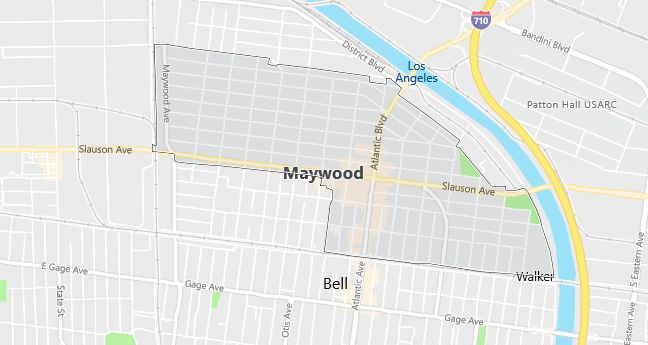
Moving to Maywood, California
Population: 28,083. Estimated population in July 2024: 28,600 (+1.8% change)
Males: 14,324 (51.0%), Females: 13,759 (49.0%)
Los Angeles County
Zip code: 90270
Demographics
Median resident age: 24.9 years
Median household income: $30,480
Median house value: $156,100
Population by Race
Races in Maywood:
- Hispanic (96.3%)
- Other race (50.5%)
- Two or more races (4.5%)
- White Non-Hispanic (2.6%)
- American Indian (1.4%)
(Total can be greater than 100% because Hispanics could be counted in other races)
Ancestries: United States (1.5%).
Elevation: 155 feet
Land area: 1.2 square miles

Population by Education
For population 25 years and over in Maywood
- High school or higher: 29.6%
- Bachelor’s degree or higher: 2.3%
- Graduate or professional degree: 0.8%
- Unemployed: 11.4%
- Mean travel time to work: 29.2 minutes
For population 15 years and over in Maywood city
- Never married: 36.5%
- Now married: 52.9%
- Separated: 3.6%
- Widowed: 3.7%
- Divorced: 3.4%
55.2% Foreign born (54.8% Latin America).
Population change in the 1990s: -17 (-0.1%).
Hospitals
Hospitals/medical centers near Maywood:
- COMMUNITY HOSP OF HUNTINGTON PARK (about 3 miles; HUNTINGTON PARK, CA)
- EAST LOS ANGELES DOCTORS HOSPITAL (about 3 miles; LOS ANGELES, CA)
- LOS ANGELES COMMUNITY HOSPITAL (about 3 miles; LOS ANGELES, CA)
Airports
Airports certified for carrier operations nearest to Maywood:
- LONG BEACH /DAUGHERTY FIELD/ (about 13 miles; LONG BEACH, CA; Abbreviation: LGB)
- LOS ANGELES INTL (about 16 miles; LOS ANGELES, CA; Abbreviation: LAX)
- LOS ALAMITOS AAF (about 17 miles; LOS ALAMITOS, CA; Abbreviation: SLI)
Other public-use airports nearest to Maywood:
- COMPTON/WOODLEY (about 8 miles; COMPTON, CA; Abbreviation: CPM)
- JACK NORTHROP FIELD/HAWTHORNE MUNICIPAL (about 12 miles; HAWTHORNE, CA; Abbreviation: HHR)
- EL MONTE (about 13 miles; EL MONTE, CA; Abbreviation: EMT)
Amtrak stations near Maywood:
- 6 miles: LOS ANGELES (800 N. ALAMEDA ST.). Services: ticket office, fully wheelchair accessible, enclosed waiting area, public restrooms, public payphones, snack bar, free short-term parking, paid long-term parking, car rental agency, taxi stand, public transit connection.
- 11 miles: GLENDALE (400 W. CERRITOS AVE.). Services: fully wheelchair accessible, public payphones, free short-term parking, free long-term parking, call for taxi service, intercity bus service, public transit connection.
- 12 miles: PASADENA (150 S. ROBLES AVE.) – Bus Station. Services: fully wheelchair accessible, enclosed waiting area, public restrooms, public payphones, full-service food facilities, paid short-term parking, paid long-term parking, taxi stand, public transit connection.
Colleges and Universities
Colleges/universities with over 2000 students nearest to Maywood:
- EAST LOS ANGELES OCCUPATIONAL CENTER (about 5 miles; LOS ANGELES, CA; Full-time enrollment: 2,186)
- EAST LOS ANGELES COLLEGE (about 6 miles; MONTEREY PARK, CA; Full-time enrollment: 12,670)
- LOS ANGELES TRADE TECHNICAL COLLEGE (about 7 miles; LOS ANGELES, CA; Full-time enrollment: 8,528)
- FASHION INSTITUTE OF DESIGN AND MERCH-LOS ANGELES (about 7 miles; LOS ANGELES, CA; Full-time enrollment: 2,112)
- CALIFORNIA STATE UNIVERSITY-LOS ANGELES (about 7 miles; LOS ANGELES, CA; Full-time enrollment: 14,556)
- COMPTON COMMUNITY COLLEGE (about 7 miles; COMPTON, CA; Full-time enrollment: 3,797)
- LOS ANGELES SOUTHWEST COLLEGE (about 9 miles; LOS ANGELES, CA; Full-time enrollment: 2,971)
Private high school in Maywood:
- FIRST BAPTIST CHRISTIAN PRESCH (Students: 205; Location: 3759 E 57TH ST; Grades: PK – 12)
Public primary/middle schools in Maywood:
- LOMA VISTA ELEMENTARY (Students: 1,548; Location: 3629 E. 58TH ST.; Grades: KG – 05)
- HELIOTROPE AVENUE ELEMENTARY (Students: 1,331; Location: 5911 WOODLAWN AVE.; Grades: KG – 05)
- FISHBURN AVENUE ELEMENTARY (Students: 1,139; Location: 5701 FISHBURN AVE.; Grades: KG – 05)
Private primary/middle school in Maywood:
- ST ROSE OF LIMA SCHOOL (Students: 265; Location: 4422 E 60TH STREET; Grades: KG – 8)
