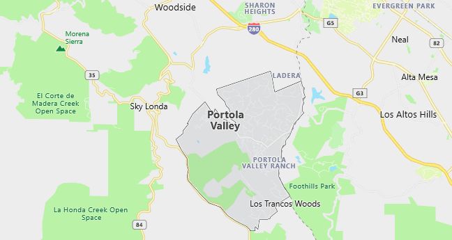
Moving to Portola Valley, California
Population: 4,462. Estimated population in July 2024: 4,417 (-1.0% change)
Males: 2,195 (49.2%), Females: 2,267 (50.8%)
San Mateo County
Zip code: 94028
Demographics
Median resident age: 47.5 years
Median household income: $158,217
Median house value: $1,000,001
Population by Race
Races in Portola Valley:
- White Non-Hispanic (90.8%)
- Hispanic (3.3%)
- Chinese (1.6%)
- Two or more races (1.4%)
- Other race (1.0%)
- Japanese (0.9%)
- Asian Indian (0.9%)
Ancestries: English (20.8%), German (15.8%), Irish (11.5%), Italian (6.4%), French (5.9%), Scottish (5.4%).
Elevation: 455 feet
Land area: 9.2 square miles
Population by Education
For population 25 years and over in Portola Valley
- High school or higher: 98.7%
- Bachelor’s degree or higher: 77.4%
- Graduate or professional degree: 41.0%
- Unemployed: 1.4%
- Mean travel time to work: 26.1 minutes
For population 15 years and over in Portola Valley town
- Never married: 17.5%
- Now married: 67.9%
- Separated: 0.0%
- Widowed: 8.3%
- Divorced: 6.3%
12.9% Foreign born (6.7% Europe, 2.6% Asia, 1.3% Latin America).
Population change in the 1990s: +309 (+7.4%).
Hospitals
Hospitals/medical centers near Portola Valley:
- LUCILE SALTER PACKARD CHILDREN’S HSP (about 4 miles; PALO ALTO, CA)
- STANFORD HOSPITAL (about 6 miles; STANFORD, CA)
- SEQUOIA HOSPITAL (about 6 miles; REDWOOD CITY, CA)
Airports
Airports certified for carrier operations nearest to Portola Valley:
- SAN FRANCISCO INTERNATIONAL (about 20 miles; SAN FRANCISCO, CA; Abbreviation: SFO)
- NORMAN Y. MINETA SAN JOSE INTERNATIONAL (about 21 miles; SAN JOSE, CA; Abbreviation: SJC)
- METROPOLITAN OAKLAND INTL (about 24 miles; OAKLAND, CA; Abbreviation: OAK)
Other public-use airports nearest to Portola Valley:
- SAN CARLOS (about 9 miles; SAN CARLOS, CA; Abbreviation: SQL)
- PALO ALTO ARPT OF SANTA CLARA CO (about 10 miles; PALO ALTO, CA; Abbreviation: PAO)
- HAYWARD EXECUTIVE (about 21 miles; HAYWARD, CA; Abbreviation: HWD)
Amtrak stations near Portola Valley:
- 19 miles: SANTA CLARA-GREAT AMERICA (SANTA CLARA, FOOT OF STARS & STRIPES DR.). Services: partially wheelchair accessible, free short-term parking.
- 20 miles: MILLBRAE (MILLBRAE AVE. & CALIFORNIA DR.) – Bus Station. Services: fully wheelchair accessible, public payphones, free short-term parking, call for taxi service, public transit connection.
- 20 miles: FREMONT (CENTERVILLE, FREMONT & PERALTA BLVDS.). Services: fully wheelchair accessible, enclosed waiting area, public restrooms, public payphones, snack bar, free short-term parking, free long-term parking, call for car rental service, call for taxi service, public transit connection.
Colleges and Universities
Colleges/universities with over 2000 students nearest to Portola Valley:
- STANFORD UNIVERSITY (about 6 miles; STANFORD, CA; Full-time enrollment: 14,955)
- CANADA COLLEGE (about 7 miles; REDWOOD CITY, CA; Full-time enrollment: 2,438)
- FOOTHILL COLLEGE (about 7 miles; LOS ALTOS HILLS, CA; Full-time enrollment: 7,415)
- DE ANZA COLLEGE (about 13 miles; CUPERTINO, CA; Full-time enrollment: 13,197)
- COLLEGE OF SAN MATEO (about 15 miles; SAN MATEO, CA; Full-time enrollment: 5,619)
- WEST VALLEY COLLEGE (about 16 miles; SARATOGA, CA; Full-time enrollment: 5,880)
- MISSION COLLEGE (about 18 miles; SANTA CLARA, CA; Full-time enrollment: 4,565)
Private high school in Portola Valley:
- WOODSIDE PRIORY SCHOOL (Students: 307; Location: 302 PORTOLA ROAD; Grades: 6 – 12)
Public primary/middle schools in Portola Valley:
- CORTE MADERA ELEMENTARY (Students: 362; Location: 4575 ALPINE ROAD; Grades: 04 – 08)
- ORMONDALE ELEMENTARY (Students: 315; Location: 200 SHAWNEE PASS; Grades: KG – 03)