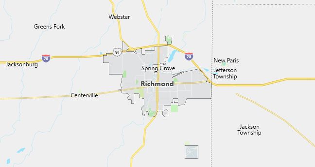
Moving to Richmond, Indiana
Population: 39,124. Estimated population in July 2024: 37,560 (-4.0% change)
Males: 18,392 (47.0%), Females: 20,732 (53.0%)
Wayne County
Zip codes: 47374.
Demographics
Median resident age: 36.3 years
Median household income: $30,210
Median house value: $73,000
Population by Race
Races in Richmond:
- White Non-Hispanic (85.9%)
- Black (8.9%)
- Two or more races (2.1%)
- Hispanic (2.0%)
- Other race (1.1%)
- American Indian (0.8%)
Ancestries: German (17.9%), United States (13.6%), Irish (10.1%), English (8.7%), Italian (2.5%), Dutch (2.0%).
Elevation: 966 feet
Land area: 23.2 square miles
Population by Education
For population 25 years and over in Richmond
- High school or higher: 74.6%
- Bachelor’s degree or higher: 13.8%
- Graduate or professional degree: 5.8%
- Unemployed: 9.1%
- Mean travel time to work: 14.9 minutes
For population 15 years and over in Richmond city
- Never married: 24.5%
- Now married: 51.6%
- Separated: 1.5%
- Widowed: 8.9%
- Divorced: 13.6%
2.4% Foreign born (0.9% Asia, 0.8% Latin America, 0.5% Europe).
Population change in the 1990s: -641 (-1.6%).
Hospitals
Hospitals/medical centers in Richmond:
- REID HOSPITAL & HEALTH CARE SERVICES (1401 CHESTER BOULEVARD)
- RICHMOND STATE HOSPITAL (498 NORTH WEST 18TH STREET)
Other hospitals/medical centers near Richmond:
- FAYETTE MEMORIAL HOSPITAL ASSOC INC (about 22 miles; CONNERSVILLE, IN)
- ST VINCENT RANDOLPH HOSPITAL INC (about 25 miles; WINCHESTER, IN)
- MCCULLOUGH-HYDE MEMORIAL HOSPITAL (about 26 miles; OXFORD, OH)
Airports
Airports certified for carrier operations nearest to Richmond:
- DELAWARE COUNTY – JOHNSON FIELD (about 44 miles; MUNCIE, IN; Abbreviation: MIE)
- JAMES M COX DAYTON INTL (about 47 miles; DAYTON, OH; Abbreviation: DAY)
- ANDERSON MUNICIPAL-DARLINGTON FIELD (about 53 miles; ANDERSON, IN; Abbreviation: AID)
Other public-use airports nearest to Richmond:
- RICHMOND MUNI (about 7 miles; RICHMOND, IN; Abbreviation: RID)
- HAGERSTOWN (about 19 miles; HAGERSTOWN, IN; Abbreviation: I61)
- METTEL FIELD (about 19 miles; CONNERSVILLE, IN; Abbreviation: CEV)