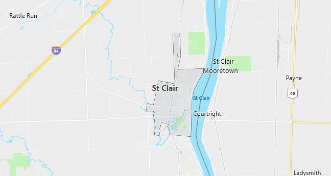
Moving to Saint Clair, Michigan
Population: 5,802. Estimated population in July 2024: 5,933 (+2.3% change)
Males: 2,722 (46.9%), Females: 3,080 (53.1%)
St. Clair County
Zip code: 48079
Demographics
Median resident age: 37.2 years
Median household income: $52,957
Median house value: $137,100
Population by Race
Races in St. Clair:
- White Non-Hispanic (96.4%)
- Two or more races (1.3%)
- Hispanic (1.2%)
- American Indian (0.6%)
Ancestries: German (31.0%), Irish (12.7%), French (10.7%), English (10.5%), Polish (10.3%), Scottish (7.3%).
Elevation: 585 feet
Land area: 2.8 square miles

Population by Education
For population 25 years and over in St. Clair
- High school or higher: 89.1%
- Bachelor’s degree or higher: 20.8%
- Graduate or professional degree: 9.3%
- Unemployed: 4.9%
- Mean travel time to work: 25.2 minutes
For population 15 years and over in St. Clair city
- Never married: 20.9%
- Now married: 61.1%
- Separated: 1.2%
- Widowed: 7.2%
- Divorced: 9.7%
3.5% Foreign born (2.5% Europe, 0.5% Asia, 0.4% North America).
Population change in the 1990s: +421 (+7.8%).
Hospitals
Hospitals/medical centers near St. Clair:
- ST JOHN RIVER DISTRICT HOSPITAL (about 5 miles; EAST CHINA, MI)
- MERCY HOSPITAL (about 12 miles; PORT HURON, MI)
- PORT HURON HOSPITAL (about 12 miles; PORT HURON, MI)
Airports
Airports certified for carrier operations nearest to St. Clair:
- DETROIT CITY (about 46 miles; DETROIT, MI; Abbreviation: DET)
- OAKLAND COUNTY INTERNATIONAL (about 66 miles; PONTIAC, MI; Abbreviation: PTK)
- DETROIT METROPOLITAN WAYNE COUNTY (about 74 miles; DETROIT, MI; Abbreviation: DTW)
Other public-use airports nearest to St. Clair:
- DAVID’S LANDING (about 4 miles; ST CLAIR, MI; Abbreviation: 5Y5)
- ST CLAIR COUNTY INTL (about 6 miles; PORT HURON, MI; Abbreviation: PHN)
- JOHNSON FIELD (about 10 miles; SMITHS CREEK, MI; Abbreviation: 11G)
Amtrak stations near St. Clair:
- 11 miles: PORT HURON (2223 16TH ST.). Services: ticket office, fully wheelchair accessible, enclosed waiting area, public restrooms, public payphones, free short-term parking, free long-term parking, call for taxi service.
- 13 miles: SARNIA (125 GREEN ST.). Services: ticket office, fully wheelchair accessible, enclosed waiting area, public restrooms, public payphones, snack bar, free short-term parking, public transit connection.
Colleges and Universities
Colleges/universities with over 2000 students nearest to St. Clair:
- ST CLAIR COUNTY COMMUNITY COLLEGE (about 12 miles; PORT HURON, MI; Full-time enrollment: 2,287)
- MACOMB COMMUNITY COLLEGE (about 41 miles; WARREN, MI; Full-time enrollment: 11,057)
- UNIVERSITY OF PHOENIX-DETROIT CAMPUS (about 49 miles; TROY, MI; Full-time enrollment: 2,090)
- OAKLAND UNIVERSITY (about 49 miles; ROCHESTER HILLS, MI; Full-time enrollment: 11,424)
- WAYNE STATE UNIVERSITY (about 51 miles; DETROIT, MI; Full-time enrollment: 20,389)
- WAYNE COUNTY COMMUNITY COLLEGE DISTRICT (about 52 miles; DETROIT, MI; Full-time enrollment: 4,414)
- MARYGROVE COLLEGE (about 54 miles; DETROIT, MI; Full-time enrollment: 5,301)
Schools
Public high schools in St. Clair:
- ST. CLAIR HIGH SCHOOL (Students: 1,011; Location: 2200 CLINTON AVENUE; Grades: 09 – 12)
- RIVERVIEW EAST HIGH SCHOOL (Students: 178; Location: 301 N. SIXTH STREET; Grades: 09 – 12)
Public primary/middle schools in St. Clair:
- ST. CLAIR MIDDLE SCHOOL (Students: 713; Location: 4335 YANKEE ROAD; Grades: 06 – 08)
- GEARING ELEMENTARY SCHOOL (Students: 477; Location: 200 N. CARNEY DRIVE; Grades: PK – 05)
- THEO V. EDDY ELEMENTARY SCHOOL (Students: 456; Location: 301 N. 9TH STREET; Grades: PK – 05)
