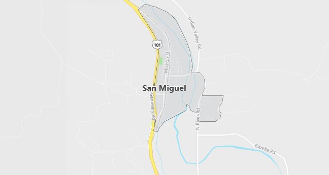
Moving to San Miguel, California
Population: 1,427
Males: 730 (51.2%), Females: 697 (48.8%)
San Luis Obispo County
Zip code: 93451
Demographics
Median resident age: 29.3 years
Median household income: $33,264
Median house value: $119,300
Population by Race
Races in San Miguel:
- White Non-Hispanic (58.0%)
- Hispanic (32.7%)
- Other race (23.8%)
- Two or more races (8.3%)
- American Indian (6.7%)
- Black (1.5%)
(Total can be greater than 100% because Hispanics could be counted in other races)
Ancestries: Irish (15.3%), German (12.4%), English (5.7%), Dutch (3.8%), Subsaharan African (3.7%), United States (3.6%).
Elevation: 640 feet
Land area: 1.7 square miles

Population by Education
For population 25 years and over in San Miguel
- High school or higher: 71.3%
- Bachelor’s degree or higher: 9.3%
- Graduate or professional degree: 1.0%
- Unemployed: 5.6%
- Mean travel time to work: 22.7 minutes
For population 15 years and over in San Miguel CDP
- Never married: 21.4%
- Now married: 60.8%
- Separated: 3.5%
- Widowed: 2.5%
- Divorced: 11.8%
13.4% Foreign born (12.2% Latin America).
Hospitals
Hospitals/medical centers near San Miguel:
- TWIN CITIES COMMUNITY HOSPITAL (about 15 miles; TEMPLETON, CA)
- SIERRA VISTA REGIONAL MEDICAL CENTER (about 33 miles; SAN LUIS OBISPO, CA)
- FRENCH HOSPITAL MEDICAL CENTER (about 34 miles; SAN LUIS OBISPO, CA)
Airports
Airports certified for carrier operations nearest to San Miguel:
- PASO ROBLES MUNI (about 8 miles; PASO ROBLES, CA; Abbreviation: PRB)
- SAN LUIS COUNTY REGIONAL (about 36 miles; SAN LUIS OBISPO, CA; Abbreviation: SBP)
- SANTA MARIA PUB/CAPT G ALLAN HANCOCK FLD (about 63 miles; SANTA MARIA, CA; Abbreviation: SMX)
Other public-use airports nearest to San Miguel:
- NEW COALINGA MUNI (about 40 miles; COALINGA, CA; Abbreviation: C80)
- TUSI AHP (HUNTER LIGGETT) (about 41 miles; FORT HUNTER LIGGET JOLON, CA; Abbreviation: HGT)
- MESA DEL REY (about 44 miles; KING CITY, CA; Abbreviation: KIC)
Amtrak stations near San Miguel:
- 9 miles: PASO ROBLES (8TH & PINE STS.). Services: fully wheelchair accessible, enclosed waiting area, public restrooms, public payphones, vending machines, free short-term parking, free long-term parking, call for taxi service, intercity bus service, public transit connection.
- 19 miles: ATASCADERO (EAST MALL & PALMA AVE.) – Bus Station. Services: fully wheelchair accessible, public payphones, taxi stand.
Colleges and Universities
Colleges/universities with over 2000 students nearest to San Miguel:
- CALIFORNIA POLYTECHNIC STATE UNIV-SAN LUIS OBISPO (about 33 miles; SAN LUIS OBISPO, CA; Full-time enrollment: 15,985)
- CUESTA COLLEGE (about 33 miles; SAN LUIS OBISPO, CA; Full-time enrollment: 6,121)
- WEST HILLS COMMUNITY COLLEGE (about 41 miles; COALINGA, CA; Full-time enrollment: 2,406)
- ALLAN HANCOCK COLLEGE (about 64 miles; SANTA MARIA, CA; Full-time enrollment: 6,037)
- HARTNELL COLLEGE (about 92 miles; SALINAS, CA; Full-time enrollment: 4,003)
- TAFT COLLEGE (about 97 miles; Taft, CA; Full-time enrollment: 2,801)
- CALIFORNIA STATE UNIVERSITY-MONTEREY BAY (about 99 miles; SEASIDE, CA; Full-time enrollment: 2,383)
Public primary/middle schools in San Miguel:
- LARSEN (LILLIAN) ELEMENTARY (Students: 390; Location: 1601 L ST; Grades: KG – 08)
- PLEASANT VALLEY ELEMENTARY (Students: 137; Location: 7000 RANCHITA CANYON; Grades: KG – 08)
- PARKFIELD ELEMENTARY (Students: 17; Location: 70585 PARKFIELD COALINGA ROAD; Grades: KG – 06)
