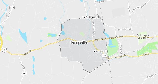
Moving to Terryville, Connecticut
Population: 5,360
Males: 2,631 (49.1%), Females: 2,729 (50.9%)
Litchfield County
Demographics
Median resident age: 36.9 years
Median household income: $48,284
Median house value: $121,700
Population by Race
Races in Terryville:
- White Non-Hispanic (96.3%)
- Hispanic (1.2%)
- Two or more races (1.1%)
- Black (0.9%)
- American Indian (0.8%)
Ancestries: Polish (19.6%), French (19.0%), Italian (15.5%), Irish (15.4%), German (13.8%), English (7.7%).
Elevation: 609 feet
Land area: 2.8 square miles

Population by Education
For population 25 years and over in Terryville
- High school or higher: 78.2%
- Bachelor’s degree or higher: 13.6%
- Graduate or professional degree: 5.4%
- Unemployed: 5.6%
- Mean travel time to work: 23.0 minutes
For population 15 years and over in Terryville CDP
- Never married: 25.8%
- Now married: 57.2%
- Separated: 1.1%
- Widowed: 7.0%
- Divorced: 8.9%
3.1% Foreign born (1.9% Europe, 0.9% North America, 0.4% Latin America).
Hospitals
Hospitals/medical centers near Terryville:
- BRISTOL HOSPITAL (about 5 miles; BRISTOL, CT)
- ST MARYS HOSPITAL (about 10 miles; WATERBURY, CT)
- BRADLEY MEMORIAL HOSPITAL & HEALTH CTR (about 11 miles; SOUTHINGTON, CT)
Airports
Airports certified for carrier operations nearest to Terryville:
- HARTFORD-BRAINARD (about 25 miles; HARTFORD, CT; Abbreviation: HFD)
- BRADLEY INTL (about 30 miles; WINDSOR LOCKS, CT; Abbreviation: BDL)
- TWEED-NEW HAVEN (about 31 miles; NEW HAVEN, CT; Abbreviation: HVN)
Other public-use airports nearest to Terryville:
- WATERBURY (about 4 miles; WATERBURY, CT; Abbreviation: N41)
- MOUNTAIN MEADOW AIRSTRIP (about 7 miles; BURLINGTON, CT; Abbreviation: 22B)
- NORTHFIELD (about 8 miles; THOMASTON, CT; Abbreviation: N09)
Amtrak stations near Terryville:
- 17 miles: BERLIN (KENSINGTON, DEPOT RD.). Services: ticket office, partially wheelchair accessible, enclosed waiting area, public restrooms, public payphones, free short-term parking, free long-term parking, call for car rental service, call for taxi service, public transit connection.
- 17 miles: MERIDEN (60 STATE ST.). Services: ticket office, partially wheelchair accessible, enclosed waiting area, public restrooms, public payphones, vending machines, call for car rental service, call for taxi service, public transit connection.
- 20 miles: WALLINGFORD (37 HALL AVE.). Services: partially wheelchair accessible, enclosed waiting area, public payphones, free short-term parking, call for car rental service, call for taxi service.
Colleges and Universities
Colleges/universities with over 2000 students nearest to Terryville:
- NAUGATUCK VALLEY COMMUNITY COLLEGE (about 10 miles; WATERBURY, CT; Full-time enrollment: 2,834)
- CENTRAL CONNECTICUT STATE UNIVERSITY (about 16 miles; NEW BRITAIN, CT; Full-time enrollment: 8,967)
- UNIVERSITY OF HARTFORD (about 20 miles; WEST HARTFORD, CT; Full-time enrollment: 5,557)
- QUINNIPIAC UNIVERSITY (about 20 miles; HAMDEN, CT; Full-time enrollment: 5,836)
- MANCHESTER COMMUNITY COLLEGE (about 22 miles; MANCHESTER, CT; Full-time enrollment: 2,863)
- TRINITY COLLEGE (about 22 miles; HARTFORD, CT; Full-time enrollment: 2,056)
- YALE UNIVERSITY (about 23 miles; NEW HAVEN, CT; Full-time enrollment: 11,011)
Schools
Public high school in Terryville:
- TERRYVILLE HIGH SCHOOL (Students: 549; Location: 21 NORTH MAIN ST.; Grades: 09 – 12)
Public primary/middle schools in Terryville:
- HARRY S. FISHER SCHOOL (Students: 482; Location: 79 NORTH MAIN ST.; Grades: 06 – 08)
- MAIN STREET SCHOOL (Students: 177; Location: 77 MAIN ST.; Grades: 03 – 05)
- PROSPECT STREET SCHOOL (Students: 170; Location: 12 PROSPECT ST.; Grades: KG – 02)
- HOMEBOUND (Location: 77 MAIN STREET; Grades: PK – 12)
