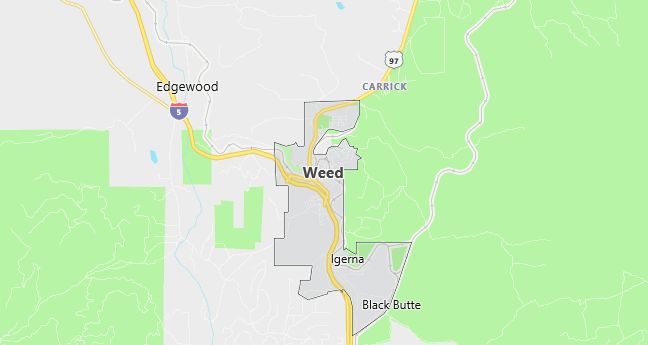
Moving to Weed, California
Population: 2,978. Estimated population in July 2024: 3,114 (+4.6% change)
Males: 1,449 (48.7%), Females: 1,529 (51.3%)
Siskiyou County
Zip code: 96094
Demographics
Median resident age: 35.3 years
Median household income: $23,333
Median house value: $72,300
Population by Race
Races in Weed:
- White Non-Hispanic (67.6%)
- Hispanic (12.8%)
- Black (9.3%)
- Other race (5.5%)
- Two or more races (5.0%)
- American Indian (4.8%)
- Other Asian (3.5%)
(Total can be greater than 100% because Hispanics could be counted in other races)
Ancestries: Italian (13.6%), German (11.4%), Irish (9.6%), English (8.5%), United States (4.6%), Portuguese (2.3%).
Elevation: 3466 feet
Land area: 4.9 square miles

Population by Education
For population 25 years and over in Weed
- High school or higher: 73.7%
- Bachelor’s degree or higher: 7.3%
- Graduate or professional degree: 2.1%
- Unemployed: 18.5%
- Mean travel time to work: 12.0 minutes
For population 15 years and over in Weed city
- Never married: 27.6%
- Now married: 51.4%
- Separated: 2.6%
- Widowed: 8.8%
- Divorced: 9.6%
9.9% Foreign born (4.2% Latin America, 3.1% Asia, 1.6% Europe).
Population change in the 1990s: -170 (-5.4%).
Hospitals
Hospitals/medical centers near Weed:
- MERCY MEDICAL CENTER MT SHASTA (about 9 miles; MOUNT SHASTA, CA)
- FAIRCHILD MEDICAL CENTER (about 29 miles; YREKA, CA)
- SHASTA COUNTY IN-PATIENT MTL HLTH SERS (about 50 miles; REDDING, CA)
Airports
Airports certified for carrier operations nearest to Weed:
- REDDING MUNI (about 64 miles; REDDING, CA; Abbreviation: RDD)
- KLAMATH FALLS (about 68 miles; KLAMATH FALLS, OR; Abbreviation: LMT)
- ROGUE VALLEY INTERNATIONAL – MEDFORD (about 73 miles; MEDFORD, OR; Abbreviation: MFR)
Other public-use airports nearest to Weed:
- WEED (about 6 miles; WEED, CA; Abbreviation: O46)
- DUNSMUIR MUNI-MOTT (about 15 miles; DUNSMUIR, CA; Abbreviation: 1O6)
- MONTAGUE-YREKA ROHRER FIELD (about 23 miles; MONTAGUE, CA; Abbreviation: 1O5)
Amtrak station near Weed:
- 17 miles: DUNSMUIR (5750 SACRAMENTO AVE.). Services: fully wheelchair accessible, enclosed waiting area, public restrooms, public payphones, free short-term parking, free long-term parking, call for taxi service.
Colleges and Universities
College/University in Weed:
- COLLEGE OF THE SISKIYOUS (Full-time enrollment: 1,484; Location: 800 COLLEGE AVE; Public; Website: www.siskiyous.edu)
Colleges and Universities
Colleges/universities with over 2000 students nearest to Weed:
- SHASTA COLLEGE (about 50 miles; REDDING, CA; Full-time enrollment: 5,251)
- SOUTHERN OREGON UNIVERSITY (about 54 miles; ASHLAND, OR; Full-time enrollment: 4,424)
- OREGON INSTITUTE OF TECHNOLOGY (about 69 miles; KLAMATH FALLS, OR; Full-time enrollment: 2,183)
- ROGUE COMMUNITY COLLEGE (about 96 miles; GRANTS PASS, OR; Full-time enrollment: 2,289)
- HUMBOLDT STATE UNIVERSITY (about 124 miles; ARCATA, CA; Full-time enrollment: 6,800)
- CALIFORNIA STATE UNIVERSITY-CHICO (about 124 miles; CHICO, CA; Full-time enrollment: 14,658)
- COLLEGE OF THE REDWOODS (about 131 miles; EUREKA, CA; Full-time enrollment: 4,071)
Schools
Public high school in Weed:
- WEED HIGH (Students: 235; Location: 909 HILLSIDE; Grades: 09 – 12)
Public primary/middle schools in Weed:
- WEED ELEMENTARY (Students: 411; Location: 575 WHITE AVE.; Grades: KG – 08)
- WYEKA VISTA COMMUNITY DAY (Students: 1; Location: 575 WHITE AVE.; Grades: KG – 08)
