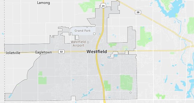
Moving to Westfield, Indiana
Population: 9,293. Estimated population in July 2024: 12,322 (+32.6% change)
Males: 4,574 (49.2%), Females: 4,719 (50.8%)
Zip code: 46074
Demographics
Median resident age: 30.2 years
Median household income: $52,963
Median house value: $133,100
Population by Race
Races in Westfield:
- White Non-Hispanic (91.9%)
- Hispanic (3.8%)
- Other race (1.9%)
- Two or more races (1.2%)
- Black (1.0%)
- American Indian (0.7%)
- Other Asian (0.5%)
Ancestries: German (28.2%), Irish (14.7%), English (13.4%), United States (8.4%), French (3.0%), Scottish (2.6%).
Land area: 7.6 square miles

Population by Education
For population 25 years and over in Westfield
- High school or higher: 90.5%
- Bachelor’s degree or higher: 35.6%
- Graduate or professional degree: 10.8%
- Unemployed: 2.7%
- Mean travel time to work: 24.0 minutes
For population 15 years and over in Westfield town
- Never married: 20.3%
- Now married: 60.8%
- Separated: 1.0%
- Widowed: 5.2%
- Divorced: 12.7%
3.6% Foreign born (1.6% Latin America, 1.5% Asia, 0.5% Europe).
Population change in the 1990s: +5,677 (+157.0%).
Hospitals
Hospitals/medical centers near Westfield:
- ST ELIZABETH ANN SETON HOSPITAL OF CEN (about 5 miles; CARMEL, IN)
- RIVERVIEW HOSPITAL (about 10 miles; NOBLESVILLE, IN)
- ST VINCENT CHILDREN’S SPECIALITY HOSPI (about 10 miles; INDIANAPOLIS, IN)
Airports
Airports certified for carrier operations nearest to Westfield:
- MOUNT COMFORT (about 22 miles; INDIANAPOLIS, IN; Abbreviation: MQJ)
- INDIANAPOLIS INTL (about 25 miles; INDIANAPOLIS, IN; Abbreviation: IND)
- ANDERSON MUNICIPAL-DARLINGTON FIELD (about 37 miles; ANDERSON, IN; Abbreviation: AID)
Other public-use airports nearest to Westfield:
- WESTFIELD (about 2 miles; WESTFIELD, IN; Abbreviation: I72)
- INDIANAPOLIS TERRY (about 9 miles; INDIANAPOLIS, IN; Abbreviation: TYQ)
- INDIANAPOLIS METROPOLITAN (about 10 miles; INDIANAPOLIS, IN; Abbreviation: UMP)
Amtrak station near Westfield:
- 19 miles: INDIANAPOLIS (350 S. ILLINOIS ST.). Services: ticket office, partially wheelchair accessible, public payphones, full-service food facilities, free short-term parking, paid long-term parking, call for car rental service, taxi stand, intercity bus service.
Colleges and Universities
Colleges/universities with over 2000 students nearest to Westfield:
- BUTLER UNIVERSITY (about 15 miles; INDIANAPOLIS, IN; Full-time enrollment: 3,721)
- INDIANA UNIVERSITY-PURDUE UNIVERSITY-INDIANAPOLIS (about 18 miles; INDIANAPOLIS, IN; Full-time enrollment: 19,818)
- IVY TECH STATE COLLEGE-CENTRAL INDIANA (about 19 miles; INDIANAPOLIS, IN; Full-time enrollment: 3,397)
- UNIVERSITY OF INDIANAPOLIS (about 25 miles; INDIANAPOLIS, IN; Full-time enrollment: 2,784)
- ANDERSON UNIVERSITY (about 34 miles; ANDERSON, IN; Full-time enrollment: 2,116)
- INDIANA WESLEYAN UNIVERSITY (about 48 miles; MARION, IN; Full-time enrollment: 6,684)
- BALL STATE UNIVERSITY (about 52 miles; MUNCIE, IN; Full-time enrollment: 17,039)
Schools
Public high school in Westfield:
- WESTFIELD HIGH SCHOOL (Students: 1,167; Location: 18250 N UNION ST; Grades: 09 – 12)
Private high school in Westfield:
- UNION BIBLE COLLEGE (Students: 64; Location: PO BOX 900; Grades: KG – 12)
Public primary/middle schools in Westfield:
- WESTFIELD INTERMEDIATE SCHOOL (Students: 744; Location: 326 W MAIN ST; Grades: 05 – 06)
- WESTFIELD MIDDLE SCHOOL (Students: 687; Location: 328 W MAIN ST; Grades: 07 – 08)
- SHAMROCK SPRINGS ELEMENTARY SCH (Students: 594; Location: 747 W 161ST ST; Grades: KG – 04)
- WASHINGTON WOODS ELEMENTARY SCHOOL (Students: 523; Location: 17950 GRASSY BRANCH RD; Grades: KG – 04)
- OAK TRACE ELEMENTARY SCH (Students: 487; Location: 16504 OAK RIDGE RD; Grades: PK – 04)
- CAREY RIDGE ELEMENTARY SCH (Students: 485; Location: 16231 CAREY RD; Grades: PK – 04)
Private primary/middle school in Westfield:
- SAINT MARIA GORETTI SCH (Students: 355; Location: 17104 SPRINGMILL RD; Grades: KG – 8)
Libraries
Library in Westfield:
- WESTFIELD PL (Operating income: $984,137; Location: 333 W HOOVER ST; 80,574 books; 5,144 audio materials; 7,124 video materials; 249 serial subscriptions)
